
Why Hike in the Gorges du Verdon
Sommaire de l'article
At the Verdon Regional Natural Park's heart, the Gorges du Verdon trace one of Europe's largest canyons: a limestone corridor carved nearly 25 km, bordered by cliffs reaching 700 m, where emerald-green waters have patiently sculpted an exceptional landscape. Here, each step changes the scene: balcony trails above Sainte-Croix Lake, canyon floor crossings near the river, open ridges with 360° views of plateaus and Pré-Alps, pine and oak forests where shade preserves coolness.
This diversity creates a profusion of hikes for all profiles: family itineraries to viewpoints, iconic crossings like Blanc-Martel, sportier climbs to summits like Grand Margès, or panoramic approaches to major viewpoints like Plein Voir Viewpoint.
Between contemplation and effort, Verdon offers a complete experience: restoration, grand spaces, and this rare sensation of exploring a territory both wild and accessible, where you compose a custom stay alternating dramatic viewpoints, peaceful swims and nature outings, directly from Aiguines and lake shores.

Top 3 Hikes in the Gorges du Verdon
This ranking was made considering the Imbut trail closure following rockfall (prohibition by municipal order still in force at writing time). Without this event, Imbut would naturally find its place in our Top 3. Before any outing, verify current orders.
Three hikes, three atmospheres: immersion at canyon floor, airy balcony over the lake, scenic summit. You choose how you wish to experience Verdon.
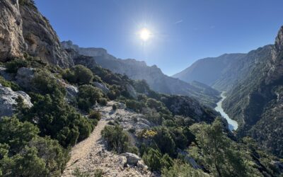
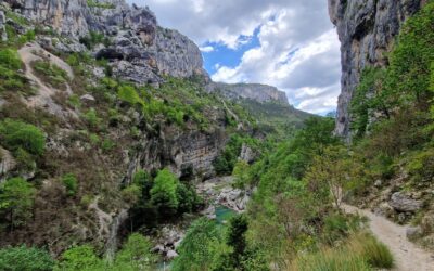
Blanc-Martel Trail — The Emblematic Immersion
The Blanc-Martel Trail (approximately 15 km) is Verdon's flagship itinerary: corniche passages, rock-carved tunnels, metal staircases and suspended viewpoints rhythm progress nearest the river. The complete itinerary links La Maline to Point Sublime; it is often done as a crossing with a shuttle (seasonal) to simplify logistics.

Practical Information
- Distance: ~14–15 km
- Elevation Gain: ~+600 m / −700 m
- Duration: 6 to 7 h depending on pace and breaks
- Trailhead: Chalet de la Maline (or Point Sublime, reverse direction)
- Gear: Hiking shoes, headlamp for tunnels, ample water, wind jacket
- Access/Logistics: Seasonal shuttles advised for crossing option
- Caution: Exposed passages (Imbert ladders), steep stairs and dark tunnels
Atmosphere & Highlights
- Canyon heart, cliff against river; mineral acoustics, underwood coolness
- Tunnels (Baou, Trescaïre), Imbert ladders, dramatic viewpoints
- Green palette (water/forest) and light limestone, changing light all day
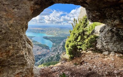
Plein Voir Viewpoint — The Grand Lake Balcony
From Aiguines/Moustiers, access to Plein Voir Viewpoint leads to one of the territory's finest observation posts: south, Sainte-Croix Lake's turquoise waters; west, the gorges entrance and Galetas Bridge; north, the ridge lace. The itinerary, demanding yet regular, unrolls a forest climb then more open passages before the viewpoint.

Practical Information
- Distance: ~9.8 km (loop)
- Elevation Gain: ~+800 m
- Duration: ~5 h (walking apart from long photo breaks)
- Trailhead: Félines parking (near Moustiers-Sainte-Marie), marked access
- Gear: Grip shoes, water, sun protection/wind jacket on ridges
- Best Light: Late afternoon and sunset (lake/cliff contrasts)
Atmosphere & Highlights
- Plein Voir Viewpoint: striking lake + gorges balcony
- Long horizon line, highly photogenic light in late day
- Trail at forest-ridge-cliff intersection
Grand Margès — The Scenic Summit (2 Variants)
More "mountain" than the previous two, the Grand Margès ascent (1,575–1,577 m) offers a 360° view of the canyon, lake, Valensole plateau and, on clear days, the Pré-Alps. Two complementary approaches: via Col d'Illoire (classic) or via Petite Forêt (more direct).

Variant A — From Col d'Illoire
- Profile: Progressive forest climb then open ridges, big mineral finish at summit
- Distance: ~10–12 km round trip, ~+800 m elevation, 5 to 6 h
- Trailhead: Col d'Illoire viewpoint (D71), or from Aiguines via GR99
- Tips: Clear weather essential (summit wind), water reserve, caution on rocky sections
Variant B — From Petite Forêt Parking (Above Aiguines)
- Profile: More direct and sustained climb from start in underwood, then quick ridge exit; favored by locals
- Distance: ~7–9 km round trip, ~+450 to +550 m elevation, 3h30 to 4h30
- Trailhead: "Petite Forêt" area (above Aiguines)
Ideal for hikers wanting to "gain the view quickly".

Before You Depart
- Verify trail conditions (Imbut closed "until further notice," summer fire restrictions, weather).
- Equip correctly (water, shoes, lamp for Blanc-Martel, wind jacket).
- Respect the reserve: stay on trails, prefer off-peak hours, pack out trash.

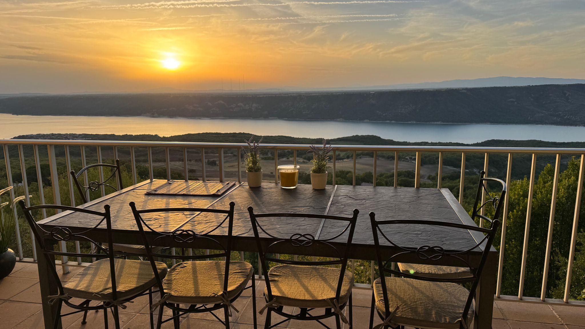
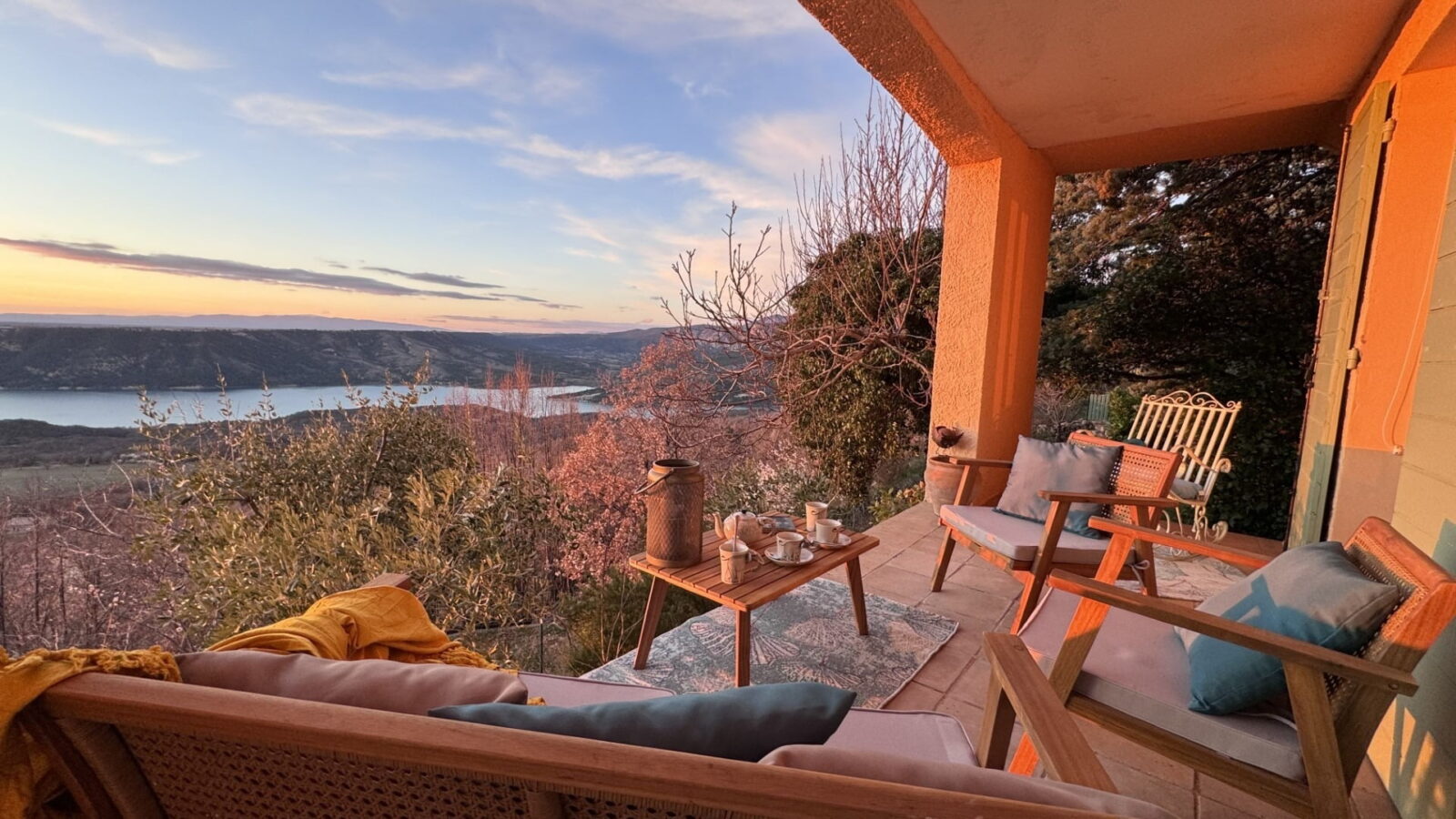
Charming house (6 pers., 3 bedrooms, ground floor, 110m² with spacious living area) with panoramic view of Lake Sainte-Croix. Quiet, 2 min walk from the village centre. Preserved nature & ideal base for outdoor activities and tourism.