
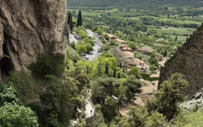
There are hikes you find in every guide, and others you discover almost by chance, on a spring Sunday. The Gorges de Baudinard hike falls into the second category. With Sylvie, we followed this calm 6.5 km loop starting from Baudinard-sur-Verdon: a lake with turquoise waters, a wild canyon, a view of Sainte-Croix dam. Nothing spectacularly difficult, just a nice walk in nature, calm and restorative. If you like hiking away from crowds and discovering preserved corners, it's a real gem just 30 minutes from Aiguines. We tell you about the route and share our hiking favorites in the Verdon.

Gorges de Baudinard: a calm corner of the Lower Gorges du Verdon
Sommaire de l'article
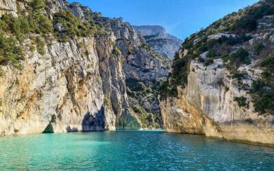
Located between Lake Sainte-Croix and Quinson, the Gorges de Baudinard form a section of the Middle Gorges du Verdon, at the border between Var and Alpes-de-Haute-Provence. The Verdon has carved a narrow canyon here over 3 km long, 100 to 150 meters deep. The place has an almost mysterious feel: you find prehistoric caves, including Église Grotto, which served as a religious shelter during the Revolution. The site is protected and accessible only on foot or by water — that's what gives it this wild, preserved character, even in peak season.
🏛️ Did you know? — Gorges de Baudinard harbors Église Grotto, a cavity that served as a clandestine place of worship during the French Revolution. Today inaccessible to the public, it testifies to this canyon's historical richness. The site also holds traces of prehistoric occupation thousands of years old.
Technical details: 📏 6.5 km loop · ⏱️ approximately 2h30 · ⛰️ +222 m / -231 m · 🥾 Moderate difficulty — rocky trail

Starting point and route: a 6.5 km loop between garrigue and viewpoints
The hike starts from parking on the D71 roadside (GPS: N 43.728555° / E 6.126502° — alt. 576 m), easily identifiable before the D9 crossing. The start is behind the water cistern — be careful not to take the nearby GR®. Follow the yellow markings ahead.
The descent starts gently through Provençal garrigue landscape — green oaks, rosemary, thyme — with pleasant views but little shade on this first section. At km 2.3 (alt. 472 m), you reach the GRP® junction (red and yellow markings).
Turn right and follow the GRP® until a fork at km 2.65 (alt. 420 m): here you leave the GRP® for a round-trip descent toward Montpezat lake (alt. 404 m, km 2.75). The descent is steep but brief — access to the lake edge is a bit "soft" as Visorando describes it, but the reward is immense.
After the lake break, climb back to the GRP® and turn left. The trail then enters a sheltered path offering stunning views of the Verdon. At km 3.55 (alt. 421 m), a first viewpoint of the Verdon opens before you. At km 5.62 (alt. 515 m), the main viewpoint offers a vertiginous view of Sainte-Croix dam, protected by a wooden barrier. Continue due south on the GRP® to close the loop and return to parking (km 6.46).

GPX trace and route map
Here's the interactive map of our itinerary with the complete GPX trace. You can zoom, click on points of interest and download the GPX file to load on your smartphone (Visorando, AllTrails, or any other hiking app).
📥 Download GPX trace — to load on your preferred hiking app.
📍 Starting point: Parking on D71, Baudinard-sur-Verdon (43.728555, 6.126502)

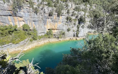
Montpezat lake: picnic break by turquoise water
The first pleasant surprise arrives at the route's lowest point, at 404 meters altitude: Montpezat lake. After leaving the GRP® for a short round-trip descent, you reach a small pebble beach on waters of almost unreal turquoise. It's calm, no one's there, just the sound of water. Sylvie and I settled there to picnic, feet almost in the water. A simple, very pleasant moment. The water colors rival the finest Verdon beaches.


💡 Local tip — Montpezat lake is an ideal picnic spot. Bring your meal: there's no resupply on the route. In summer, the water is tempting but swimming isn't officially authorized. Bring at least 1.5 liters water per person — some sections are very sun-exposed.
Trail in balcony: fine views of the canyon
After the lake break, the trail climbs the right bank and switches to a balcony path above the Verdon. This is the hike's prettiest part. The trail, sheltered by Mediterranean vegetation, offers fine views of the Verdon below — the water is a deep emerald green, framed by limestone cliffs striped with ochre and gray. Two equipped viewpoints punctuate the route: the first, with a wooden barrier, overlooks the canyon directly; the second opens onto Sainte-Croix dam in the distance. Take time to stop, it's worth it.


⚠️ Several trail sections border cliffs without protection. Stay vigilant, especially with children. Wear hiking shoes with good grip — terrain is rocky in places.


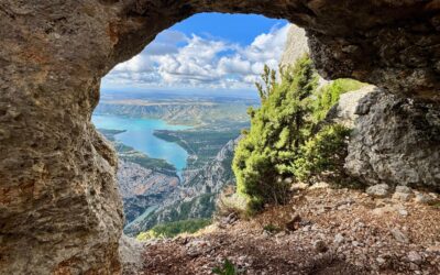
The view of Sainte-Croix dam: the hike's finest moment
The best arrives in the final third of the route. From the trail heights, you discover a really fine view: the Baudinard Gorges canyon with its ochre-striped cliffs, the emerald Verdon far below, and beyond Sainte-Croix dam with the lake stretching behind, ringed by mountains. It's one of those panoramas you don't expect to find on a short hike, yet it's almost absent from standard tourist guides. A real hidden corner of the Verdon to discover.


Practical info and tips for successful hiking
This hike is about 30 minutes drive from Aiguines (25 km via D71). Parking is free, arranged on the roadside, before the D9 crossing. Yellow then red-and-yellow (GRP) markings are well maintained and easy to follow. Best seasons for this hike are spring (March to June) and fall (September-October): in peak summer, sun exposure makes some sections challenging. We did it late March and conditions were perfect — generous sun, pleasant temperatures, and spring greenery bursting everywhere.
For map lovers, IGN references are 3342ET and 3442OT. If you're staying in the region, this hike combines nicely with a visit to Moustiers-Sainte-Marie or a day of lake swimming — the perfect program for a week's stay in the Gorges du Verdon.
What to remember
- 6.5 km loop — 2h30 — elevation +222 m — moderate difficulty
- Start: D71 parking in Baudinard-sur-Verdon (GPS: N 43.728555° / E 6.126502°)
- Highlights: Montpezat turquoise lake, canyon views, Sainte-Croix dam
- Gear: hiking boots, 1.5L water, picnic, hat
- Best period: spring and fall (avoid peak summer)
- 30 min from Aiguines — perfect to complement a Verdon stay
Frequently asked questions about Gorges de Baudinard hike
Is the Gorges de Baudinard hike suitable for families?
Yes, as long as children are used to walking. The 6.5 km route with 222 m elevation is accessible from age 8-10. However, pay attention to cliff-edge passages requiring vigilance with younger ones.
Can you swim in Montpezat lake?
The lake is tempting with its turquoise waters, but swimming isn't officially managed. However, for regulated swimming, Lake Sainte-Croix is 20 minutes drive and has many equipped beaches.
How long does the hike take?
Count 2h30 of effective walking. With photo breaks (and there will be plenty!) and a picnic at Montpezat lake, plan rather a full half-day — that's what we did and it was perfect.
How do you access Gorges de Baudinard from Aiguines?
From Aiguines, take the D71 toward Baudinard-sur-Verdon. Allow approximately 30 minutes drive (25 km). Parking is on the D71 roadside, before the D9 crossing. To get oriented, check our guide to driving routes in the Verdon.
What other hikes are there in the Gorges du Verdon?
The Verdon abounds in beautiful trails. Don't miss the famous Blanc-Martel Trail, the Plein Voir Viewpoints hike above the lake, or discover our selection of 15 must-do activities in the gorges.
Gorges de Baudinard Hike Guide
Plan your 6.5 km loop hike: turquoise Montpezat lake, canyon balcony trail, and Sainte-Croix dam panorama. Perfect for a spring or fall day trip from Aiguines — 2h30 moderate hike with stunning photography opportunities and picnic spot by the water.
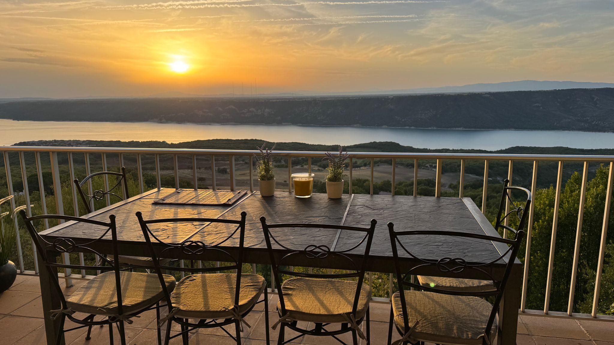
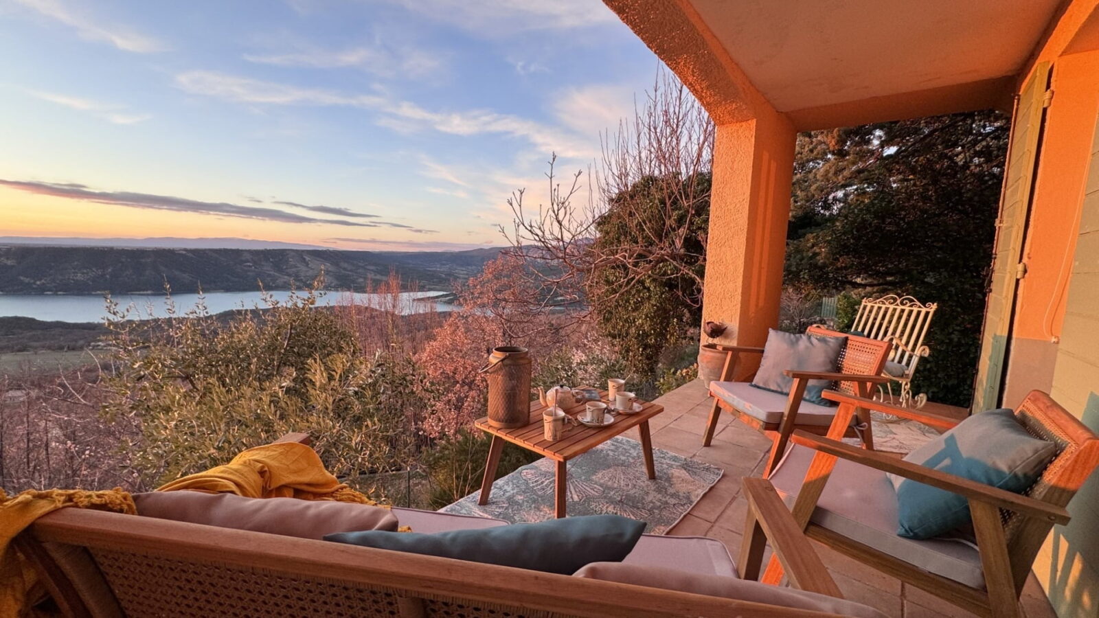
Charmante maison (6 pers., 3 ch. en rez de jardin, 110m² dont spacieux espace séjour/cuisine) avec vue panoramique sur le lac Sainte-Croix. Calme, à 2 min du centre du village à pied. Nature préservée & base idéale pour activités de pleine nature et tourisme.
Publications similaires :
 Randonnée des Gorges de Baudinard : lac turquoise, canyon secret et barrage de Sainte-Croix
 Hike to the Plein Voir Viewpoints at Sainte-Croix Lake
 Hike Baisse de Courchon (920m): loop via Ravin de Notre-Dame from Moustiers-Sainte-Marie
 Holiday rental Gorges du Verdon: direct owner – Lake Sainte-Croix house in Aiguines